Toquaht Lands
The Maa-nulth Treaty, which came into effect on April 1, 2011, marked a significant milestone for the Toquaht Nation and four other First Nations in British Columbia. This treaty represented the first multi-nation treaty in the province. A crucial aspect of this agreement was the newfound autonomy it granted the Maa-nulth Nations over their lands.
"I found it a really sad day for me when we first started negotiating for land, and my father was sitting there with the government people asking for land back that was his. He always maintained to the government ‘this is my land’. He’d get angry sometimes… in our hearts our traditional territory is our land. It always will be."
wiicackum, taayii ḥaw̓ił (Chief Anne Mack)
Previously, under the Indian Act, First Nations had no decision-making authority regarding the lands they had inhabited since time immemorial. However, the implementation of our modern-day treaty transformed this situation. It provided us with the agency to determine the fate of our land, free from government control. No longer are we required to seek permission. The land now belongs to us.
Moving forward, the Toquaht Nation envisions a thriving community within Toquaht Lands, complete with essential services, educational opportunities, and employment prospects. Our goal is to shape our own future and create a self-sustaining community that meets the needs and aspirations of our people.
Treaty Settlement Lands
Following the implementation of the Maa-nulth Treaty in 2011, Toquaht Nation experienced a significant shift in our governance and land ownership. Liberated from the constraints of the Indian Act, we gained jurisdiction over a total of 1,489 hectares of land, comprising 196 hectares of former reserve lands and an additional 1,293 hectares of former provincial Crown land.
These lands, known as Treaty Settlement Lands or Toquaht lands, can be seen on the map below:
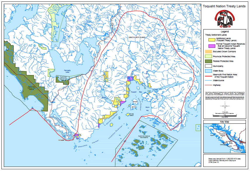
The red line delineates the boundary of our traditional territory, acknowledged in the treaty. The pink represents the former reserves we acquired ownership of, and the yellow represents the additional lands we acquired ownership of.
Toquaht Treaty Settlement Land now (circa 2024) encompasses a total of 1,8141 hectares, including 352 hectares of newly acquired Treaty Settlement Lands. As a result of this treaty, the Toquaht Nation holds the authority to establish laws governing all of our treaty settlement lands, while federal and provincial laws also continue to apply. In cases where conflicts arise between different laws, the treaty explicitly outlines which jurisdiction takes precedence.
Land Before Treaty
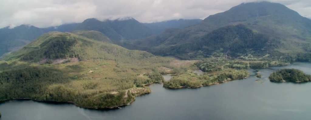
Historically, our citizens lived among seven traditional village sites spread across our extensive 38,000-hectare traditional territory, encompassing Toquaht Bay, Mayne Bay, and Western Barkley Sound. However, due to colonial rule and the implementation of the Indian Act, our Nation was allocated a mere 196 hectares of reserve lands, a small portion within our much larger traditional territory. In fact, the reserve lands in Canada are not owned by First Nations; instead, they are owned by the federal government and reserved for use by Indian Act bands.
Following the settlement of the treaty, the following five specific sites have been designated for the Toquaht Nation and now fall under our full jurisdiction:
- Chenatha (25.1 hectares)
- Chequis (1.2 hectares)
- Deekyakus (86.6 hectares)
- Dookqua (7.3 hectares)
- Stuart Bay (24.3 hectares — this site was designated as reserve in the 1950s)
Among these, our primary residential area for our citizens is m̓aʔaquuʔa (Macoah), spanning 50.2 hectares along the Macoah Passage to the west of Toquaht Bay on the northern side of Barkley Sound. Access to this area is possible via the sea or through the Maggie Lake Forest Service Road off Highway 4.
Although m̓aʔaquuʔa had been uninhabited for a period, approximately 25 years ago our masčim (citizens) returned to the site and nine homes were constructed. Currently, around 40 people reside in this community.
Additional Lands
The Maa-nulth Treaty grants us the freedom to govern our land independently and make decisions that prioritize the well-being of our Nation and People. It also provides a framework for incorporating additional fee-simple land into our treaty lands in the future. As an example, in 2014, we acquired an additional 68 hectares of fee-simple lands, which were subsequently integrated into our treaty lands. This expansion has increased the total area of Toquaht lands to 1,557 hectares, with the potential for further growth down the line.
During the negotiation of the Maa-nulth Treaty, the nations faced challenges in regaining all of their lands, some of which had transitioned into private ownership. However, they successfully secured a provision in the treaty granting them first rights should any of the private lands become available for sale. It is through this clause that we have been able to reclaim our land. The land rightfully belongs to our Nation once again.
Additionally, the Toquaht Nation has the opportunity to acquire additional provincial Crown lands identified within 15 years of the Treaty Effective Date. This means that our overall land base has the potential to expand over time, contributing to the growth and development of our Nation.